When a trenchless crossing was proposed beneath the Kirikiriroa stream a few years ago, the initial boreholes pulled up nearly seven metres of highly compressible peat before reaching the pumiceous sands underneath. That sequence, repeated across much of Hamilton’s floodplain, turns routine tunnelling into a ground-loss management exercise. The city sits on a thick package of Holocene alluvium draped over the Hinuera Formation, and the water table often sits less than two metres below street level. Tunnel design here is not about rock strength; it is about controlling face extrusion, predicting long-term consolidation settlements that can reach 150 mm or more, and selecting a support pressure that keeps the Waikato’s sensitive clays from remoulding. Our laboratory is accredited to ISO 17025 and runs each undisturbed sample through the testing sequence that NZGS guidelines demand for soft-ground projects: oedometer, triaxial CU, and index testing to confirm organic content. Before the TBM arrives, we often pair the borehole logging with CPT testing to capture a continuous tip-resistance profile, because peat layers as thin as 200 mm can dictate the entire face pressure strategy if they go undetected between Shelby tube samples.
Peat layers under 200 mm thick can dictate the entire face pressure strategy if missed between Shelby tube samples.
Methodology applied in Hamilton
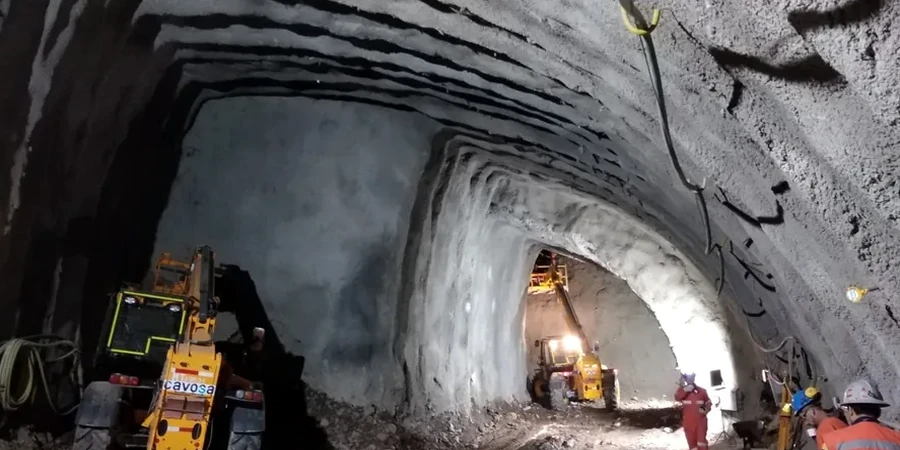
Typical technical challenges in Hamilton
Hamilton’s expansion since the 1960s pushed residential subdivisions onto low-lying peatlands that earlier generations had used only for drainage and grazing. That history matters for tunnel engineering because the pre-construction drainage patterns are still active, and any tunnel that acts as a partial barrier can pond groundwater on the upstream side, raising pore pressures and softening the ground around the lining. The biggest risk is not collapse during excavation but long-term surface settlement: soft peats continue to consolidate under the small stress changes that a tunnel introduces, sometimes for three to five years after construction. Where the alignment passes beneath State Highway 1 or the East Coast Main Trunk railway, differential movement tolerance drops to millimetres. We quantify that risk with instrumented oedometer suites and coupled flow-deformation modelling, delivering settlement troughs that the structural team can use to design articulation joints and compensation grouting arrays before the first cutterhead rotation.
Our services
The soft-ground tunnel analysis package we deliver for Hamilton projects spans from pre-feasibility desk studies through to instrumentation monitoring during the drive.
Site-specific ground model
Integration of CPTu, borehole logging, MASW geophysics, and laboratory index testing into a 3D geotechnical model with clearly defined engineering units.
Advanced laboratory programme
Oedometer, consolidated-undrained triaxial with pore pressure measurement, ring shear for residual strength, and organic content determination following NZS 4402 methods.
Numerical deformation analysis
PLAXIS 2D and 3D finite-element simulations of staged excavation, face support pressure optimisation, and long-term consolidation settlement prediction.
Construction-phase monitoring plans
Specification of surface settlement arrays, in-tunnel convergence markers, and piezometer networks with alert thresholds tied to the ground model predictions.
Frequently asked questions
What is the typical cost range for a soft-ground tunnel geotechnical analysis in Hamilton?
How many boreholes are needed for a typical soft-ground tunnel alignment in the Waikato?
NZGS guidance recommends spacing investigation points at no more than 50 to 100 metres along the tunnel centreline for soft-ground conditions, with additional offset boreholes at shaft locations and where the alignment crosses known peat basins. In Hamilton’s alluvial setting, we usually specify a minimum of one borehole every 60 metres, with continuous CPT soundings between boreholes to capture thin peat seams that would otherwise remain undetected.
Which laboratory tests are essential for Hamilton’s peaty and alluvial soils?
The core suite includes oedometer consolidation tests to determine compression index and coefficient of consolidation, consolidated-undrained triaxial tests with pore pressure measurement for effective stress strength parameters, loss-on-ignition testing to quantify organic content, and Atterberg limits to classify the fine fraction. For sensitive silts with elevated liquidity indices, we add fall-cone sensitivity tests and ring-shear residual strength determinations because the remoulded behaviour governs face stability.
How do you handle groundwater during tunnel design beneath the Waikato floodplain?
We install standpipe and vibrating-wire piezometers during the ground investigation to map the phreatic surface and identify any artesian layers within the Hinuera sands. The pore pressure data feeds directly into the PLAXIS model as initial conditions, and we run sensitivity analyses with groundwater levels raised by 0.5 to 1.0 metre to account for seasonal fluctuations and long-term recharge patterns that are common in Hamilton’s peatlands.